A Shop.AlbertaParks.ca account is required. Reserve.AlbertaParks.ca accounts have not been transferred. Here's what you need to know.

Header Menu Button mobile Alberta

Kananaskis Backcountry Camping, AB

Description

Backcountry camping involves travelling on foot, bike, horse or by boat at least 1 km to a campground inaccessible by motorized vehicles. A ...[more]
Alerts and Important Information

Buy a Permit at Kananaskis Backcountry Camping, AB

Find Permits

Find your perfect Backcountry Campground

You can start by simply selecting a backcountry campground and a start date of your choice.

We'll sort your results by what is available.

Permit Area Map
Overview

Description

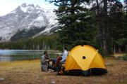
Backcountry camping involves travelling on foot, bike, horse or by boat at least 1 km to a campground inaccessible by motorized vehicles.


A Kananaskis Conservation Pass is required.


Designated backcountry campgrounds located in Kananaskis Country are available for bookings.


  • Bow Valley Wildland Area: Jewell Bay and Quaite Valley.
  • East Kananaskis Area: Big Elbow, Big Elbow Equestrian, Elbow Lake, Mount Romulus, Mount Romulus Equestrian, Tombstone and Tombstone Equestrian.
  • Kananaskis Valley Area: Lillian Lake, Ribbon Falls and Ribbon Lake.
  • Upper Kananaskis Lake Area: Aster Lake, Forks, Point, Three Isle Lake and Turbine Canyon.
  • Spray Valley Area: Rummel Lake offers winter backcountry camping.

Suggested routes and trip planning are available on AlbertaParks.ca.


Other backcountry camping opportunities are available in Alberta Parks.

Getting There
GPS Info. (Latitude, Longitude):
50.83094, -115.05006
50°49'51"N, 115°3'0"W

    Bow Valley Wildland
  • Jewell Bay 51.02358, -115.08208
  • Quaite Valley 51.05333, -115.11447

  • East Kananaskis
  • Big Elbow 50.72377, -114.85964
  • Elbow Lake 50.63744, -115.00924
  • Mount Romulus 50.76182, -114.98882
  • Tombstone 50.67561, -114.97303

  • Kananaskis Valley
  • Lillian Lake 50.86374, -115.25266
  • Ribbon Falls 50.8922, -115.22912
  • Ribbon Lake 50.88651, -115.24808

  • Upper Kananaskis Lake
  • Aster Lake 50.58125, -115.20572
  • Forks 50.63474, -115.23245
  • Point 50.62745, -115.17889
  • Three Isle Lake 50.63009, -115.26734
  • Turbine Canyon 50.68672, -115.2751

  • Spray Valley
  • Rummel Lake Winter 50.83489, -115.29757

Kananaskis Visitor Information Centre at Barrier Lake
GPS Coordinates: 51.04842, -115.02272


Elbow Valley Visitor Information Centre
GPS Coordinates: 50.91216, -114.63179


Peter Lougheed Park Discovery & Information Centre
GPS Coordinates: 50.68622, -115.11419

Contact Information

Mailing Address:

Kananaskis Backcountry Camping
Alberta Parks Headquarters, 9th Flr, 9820-106 St NW
Edmonton,  AB  T5K 2J6
Phone Number:
Information:  1-877-537-2757
Photos

Nearby Parks

* in straight line, not driving distance.
X